8.1
Wildland
1–2 hours
Time
Paid for vehicle access
Cost
Dramatic
Feel
Why it's Wildland
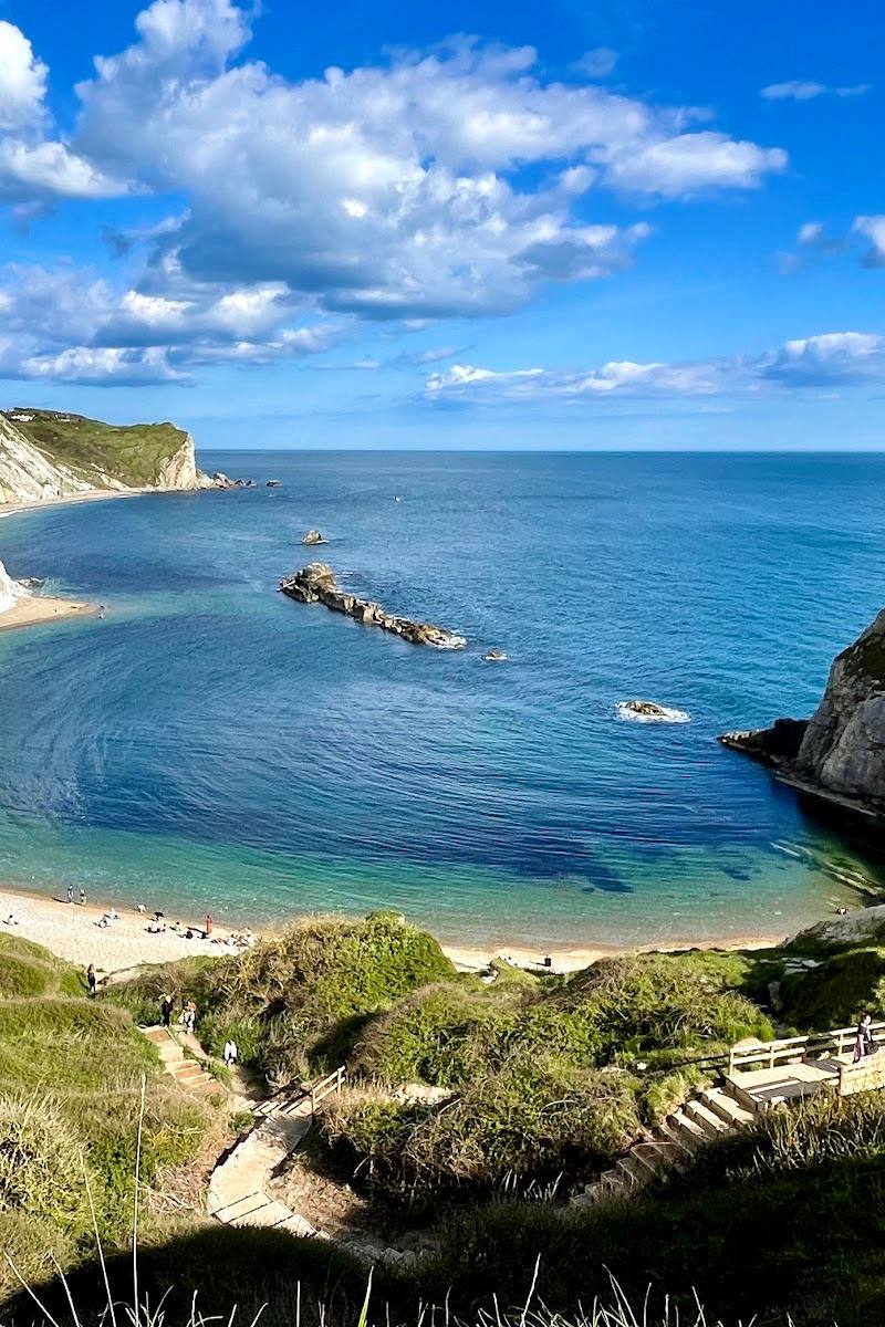
8.1Dark, fossil-rich shore platforms make Kimmeridge Bay a place to read deep geological time in the landscape. Beyond the tide line, the Jurassic Coast setting is joined by wartime defences and a clifftop folly.
Kimmeridge earns its place for the rare combination of a striking rocky bay, internationally significant Jurassic Coast geology and visible traces of more recent history. It rewards slow exploration of the shore as much as a look across the water.
Dramatic · Wild · Atmospheric
Find your way
Open mapKimmeridge, Isle of Purbeck, Dorset
Opening map…
Know this place a little better?
The experience
Explore the rocky shoreline and its geological character, then use the waymarked pedestrian link to connect the bay with Kimmeridge village. Check tides, conditions and current access information first.
Things to do
Explore the rocky shore
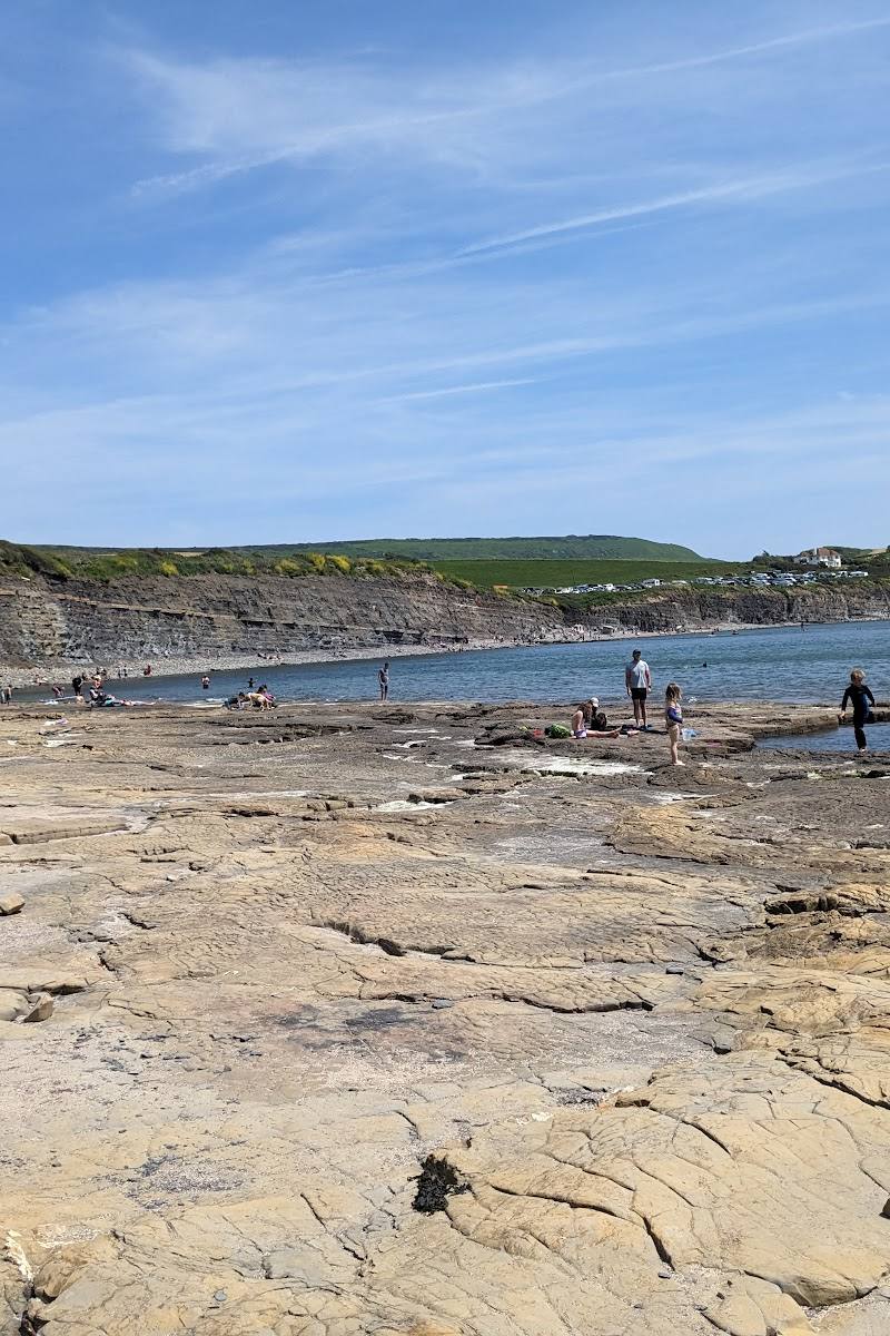
Walk the shore at a suitable tide and look closely at the dark ledges and fossil-bearing strata. Check local conditions and tide times; do not assume all areas are safe or accessible.
Variable
Follow the bay-to-village trail
Use the improved pedestrian link between Kimmeridge Bay and the village; interpretation panels and wayfinding fingerposts explain connections between present-day wildlife and geological time.
Check route distance and conditions before setting out
Look for wartime coastal defences
The supplied local source identifies a pillbox on the beach and anti-tank “dragon’s teeth” around the bay.
Part of a shoreline visit
Visit the Etches Collection
The fossil museum is in Kimmeridge village. Check current opening times and admission before visiting.
View Clavell Tower from the bay
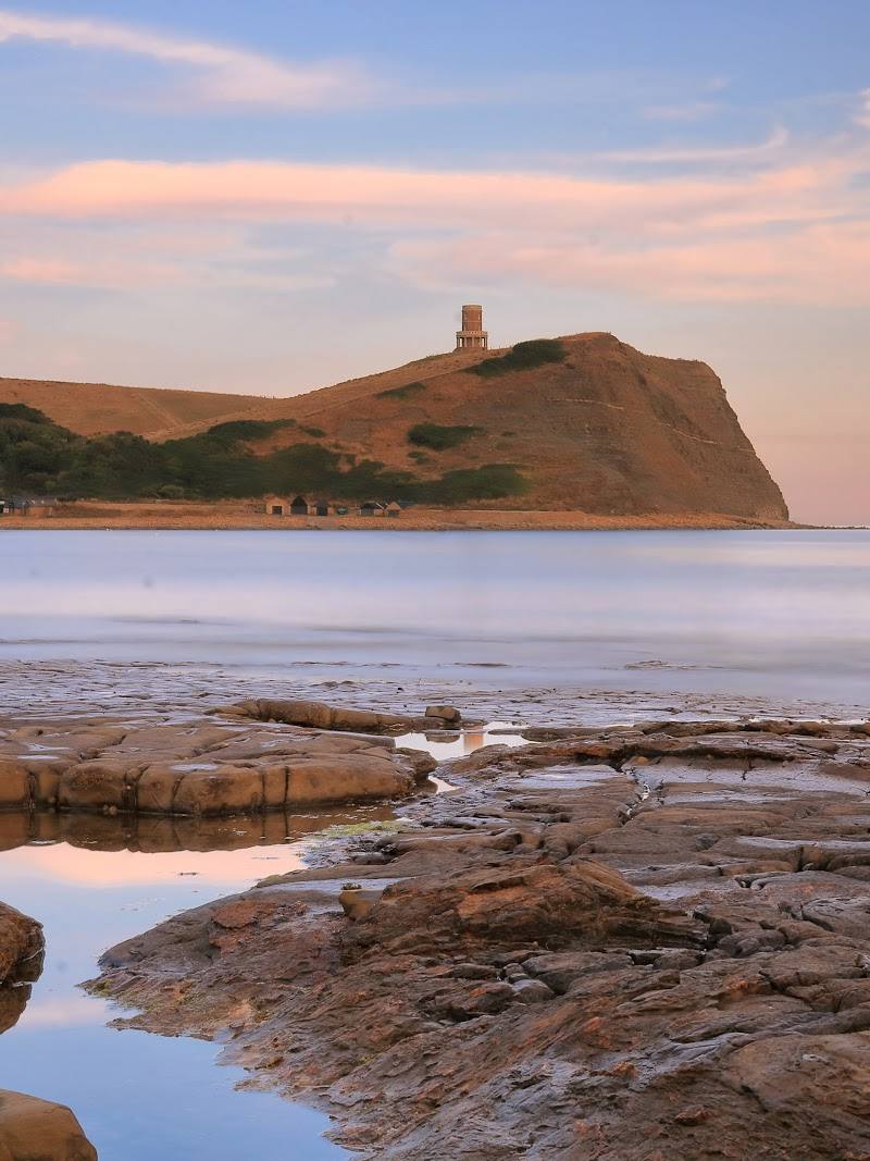
The nineteenth-century tower stands on the cliff above the bay. The supplied source says it was built as an observatory and folly and relocated and reconstructed in 2008; access inside is not established here.
Make a day of it
Quick escape · About 1–2 hours; check conditions and tide times
Quick Escape: shore and geology
- 01
Use the bay car park, checking current vehicle access and charges.
- 02
Explore the accessible shoreline at a suitable tide and look for the dark ledges and fossil-rich strata.
- 03
Notice the pillbox and anti-tank defences described in the supplied local information.
Half day · Allow a half day; timings depend on conditions and museum availability
Bay to village: a coastal and fossil day
- 01
Begin at Kimmeridge Bay and explore the shore when tide and conditions are suitable.
- 02
Follow the improved pedestrian trail linking the bay and village, using its interpretation and wayfinding panels.
- 03
Visit the Etches Collection in the village; check its current opening and admission details before travelling.
- 04
Explore the village’s historic features, including the church, described by the source as twelfth-century in origin.
Verified history
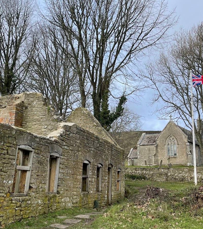
Kimmeridge village is described by the Etches Collection as a medieval settlement mentioned in the Domesday Book. Its parish church is twelfth-century in origin, though mostly rebuilt in 1872. Clavell Tower was built in 1831 by the Reverend John Richards Clavell as an observatory and folly; the source says it was later relocated and reconstructed by the Landmark Trust in 2008. The bay also retains visible Second World War defences, including a pillbox and anti-tank obstacles.
Hidden details
Wartime defences on the shore — Look for the pillbox on the beach and the anti-tank “dragon’s teeth” noted by the local museum source.
Clavell Tower’s former role — The tower was built as an observatory and folly. The source also says sailors and smugglers once used it as a navigation mark.
Geological interpretation along the trail — Wayfinding fingerposts on the bay-to-village trail connect creatures found today with wildlife from geological time.
When to go
· Check tides, weather and current access conditions; no specific time of day is supported by the supplied sources.
The supplied evidence does not establish a best season. Shore exploration depends on safe conditions and tide timing.
Coastal conditions and tides affect shore visits. Check forecasts, tide information and local guidance before going; no detailed safety guidance is established by the supplied sources.
Worth pairing with
The Etches Collection
A fossil museum in Kimmeridge village, connected to the bay by an improved pedestrian trail. Check current visitor arrangements before travelling.
Kimmeridge village
A short distance from the bay, with a conservation area and a church described as twelfth-century in origin.
What to look for
Look for the dark shore ledges and fossil-bearing strata, the pillbox on the beach and the anti-tank “dragon’s teeth” described in the supplied sources. Clavell Tower stands on the cliff above the bay.
The story
Jurassic Coast geology; Kimmeridge village’s medieval history; Second World War coastal defences
Best time to go
Check tide times and conditions before visiting; no specific peak season is established by the supplied sources.
Choose a visit around suitable tide and weather conditions. The supplied sources do not specify a best time of day or seasonal peak.
How long to spend
1–2 hours; allow longer to visit the village
Perfect for
Walkers · Photographers · History lovers · Wildlife lovers
Before you go
Address
Phone
Website
Listed hours
- Monday: 8am-5pm
- Tuesday: 8am-5pm
- Wednesday: 8am-5pm
- Thursday: 8am-5pm
- Friday: 8am-5pm
- Saturday: 8am-5pm
- Sunday: 8am-5pm
Check before visiting.
Google rating
Practical information
Opening & access
The bay is reached by a privately owned approach road. Access on foot or by bike is free; vehicles incur a toll. Check current access arrangements before setting out.
Check before visiting
Parking
The main car park overlooks the bay; vehicle access uses the toll road. Check current charges and arrangements before visiting.
Check before visiting
Toilets
Toilets are reported at the Slip-Way Car Park; check availability before visiting.
Check before visiting
Food & drink
Check before visiting. The supplied research mentions Clavell’s restaurant and café in Kimmeridge village but does not confirm current opening arrangements.
Check before visiting
Dogs
Well-behaved dogs are welcome; clean up after them.
Accessibility
The source row reports a wheelchair-accessible car park and seating. It does not establish the accessibility of the shore or paths; check before visiting.
Check before visiting
Cost
Paid for vehicle access; free on foot or by bike, according to the official site.
Water
Sea
Gallery
Place photographs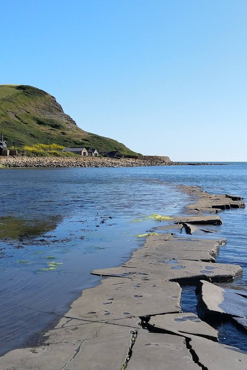
Keep exploring
Around Kimmeridge Bay
Within 50 km · approximate straight-line distances