7.4
Wildland
Half day
Time
Check
Cost
Atmospheric
Feel
Why it's Wildland
Elite7.4Waterfalls and old industrial workings give this wooded valley more than one story to tell.
The appeal is the contrast: a wooded valley with waterfalls, a reservoir and visible traces of industry, rather than scenery alone. The documented circular walk gives it substance as a half-day destination, though the evidence does not justify the seed's national-elite rating.
Atmospheric · Wild
Find your way
Ceredigion, Wales
Exact map location needs checking before visiting.
Know this place a little better?
The experience
Allow a half day for the documented Cwm Rheidol Circular. Its 5.3-mile loop combines valley views and waterfalls with the hydroelectric station and old industrial workings. Check the mapped start and current conditions before setting out: the published walking estimate is 2–2.5 hours, without extended stops.
Things to do
Walk the Cwm Rheidol Circular
Follow the documented 5.3-mile loop through the valley. AllTrails grades it Moderate and lists 462 feet of elevation gain; its description highlights waterfalls and industrial remains.
2–2.5 hours walking
Look for the valley's working landscape
On the documented circuit, look for the hydroelectric station and old industrial workings. Observe from the walking route; the sources do not establish access inside operational buildings or ruins.
Make a day of it
Quick escape · 2–2.5 hours walking; allow longer for stops
The valley circuit
- 01
Check the Cwm Rheidol Circular map, starting arrangements and recent conditions before travelling.
- 02
Follow the published 5.3-mile loop rather than an improvised route through the valley.
- 03
Pause at the waterfalls and notice how the hydroelectric station and old industrial workings sit within the wooded landscape.
- 04
Complete the circuit, allowing extra time if the paths are muddy.
Verified history
This is not simply an untouched wooded valley. The walking source identifies several old industrial workings alongside the hydroelectric station, while Statkraft identifies the Rheidol Hydropower Scheme and its visitor centre. Those features support an industrial thread to the visit, but the supplied excerpts do not establish construction dates, the functions of individual ruins or a detailed historical chronology.
When to go
· Allow enough daylight for the complete circuit; no particular hour is supported by the supplied evidence.
The route description reports mud during wetter months. No source establishes a specific seasonal wildlife or landscape peak.
Expect muddy sections in wet weather. The route source recommends appropriate footwear and layers.
The route
- ascent
- 462 feet / approximately 141 metres
- surface
- Some sections become muddy during wetter months; full surface details are not supplied.
- distance
- 5.3 miles / approximately 8.5 km
- duration
- 2–2.5 hours
- difficulty
- Moderate, as graded by AllTrails
- route shape
- Loop
- Waterfalls
- Valley views
- Hydroelectric station
- Old industrial workings
Worth pairing with
Vale of Rheidol Railway
A worthwhile alternative perspective on the wider valley: the operator confirms heritage steam journeys between Aberystwyth and Devil's Bridge. Check the current timetable and booking options separately; no direct connection with the circular walk's start has been verified.
What to look for
Look for the contrast between waterfalls and the hydroelectric station, and for old industrial workings beside the walking landscape. The route page also identifies Cwm Rheidol Reservoir and Ffrwd Ddu, labelled as ruins, among its sights.
The story
Industry
Best time to go
Choose a spell of drier weather; a destination-specific seasonal peak is not established.
Prefer drier ground conditions and enough daylight to complete the circuit comfortably. The supplied route description specifically warns of mud in wetter months.
How long to spend
Half day
Perfect for
Walkers · Photographers
Practical information
Opening & access
A published circular walking trail provides evidence of visitor access. Exact starting arrangements, local restrictions and current path conditions need checking before visiting.
Check before visiting
Parking
Check before visiting
Check before visiting
Toilets
Check before visiting
Check before visiting
Food & drink
Check before visiting
Check before visiting
Dogs
Check before visiting
Check before visiting
Accessibility
The documented circuit is 5.3 miles with 462 feet of ascent and is graded Moderate. Muddy sections are reported; step-free access is not established.
Cost
Check before visiting
Check before visiting
Water
River, Reservoir, Waterfall
Gallery
Place photographs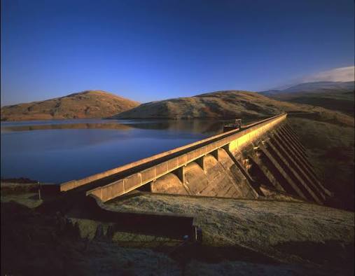
Keep exploring
Around Cwm Rheidol
No other mapped Wildland places within 50 km yet.