Above Balmaha, on the eastern shore of Loch Lomond, Scotland
Conic Hill
route · Countryside walk
Place photograph
8.0
Wildland
Half day
Time
Check
Cost
Dramatic
Feel
Why it's Wildland
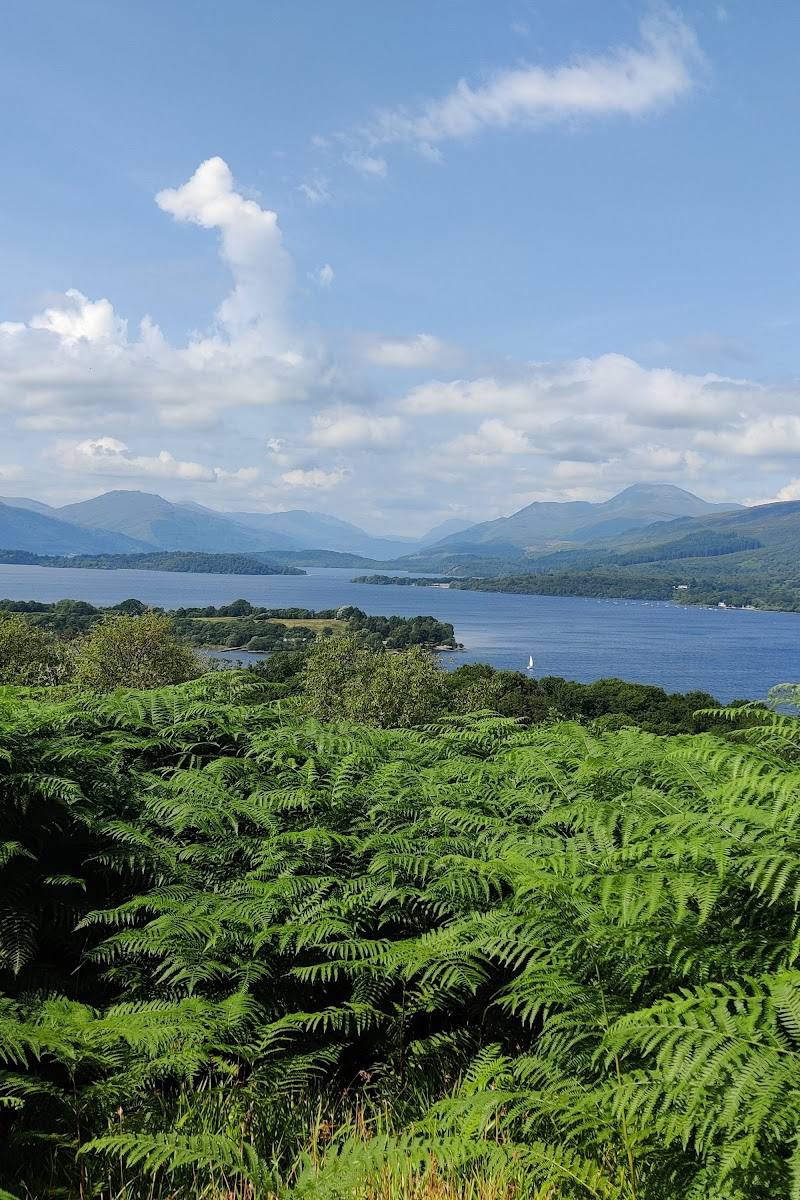
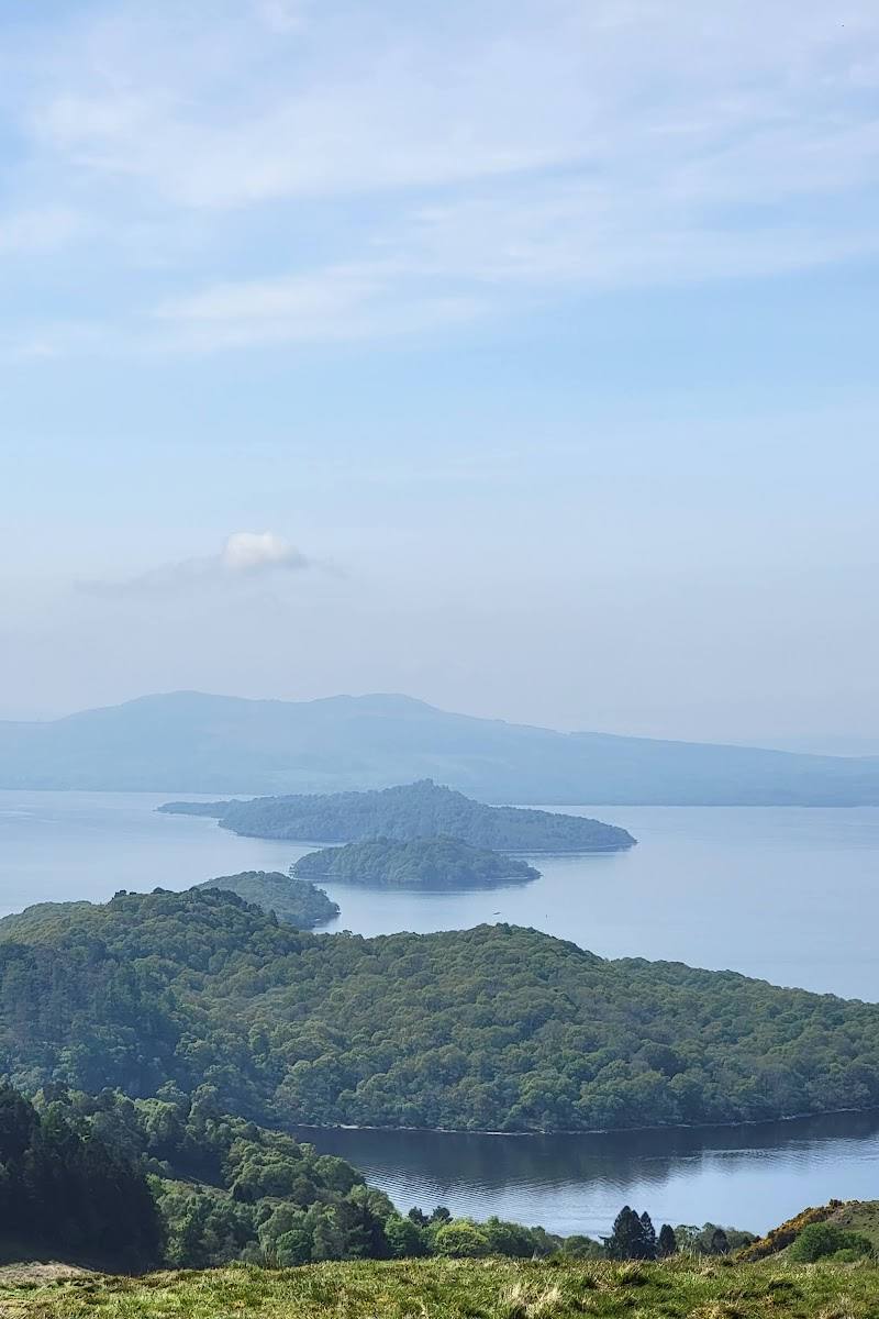
8.0A short, steep climb above Balmaha reaches a viewpoint on the Highland Boundary Fault, looking across Loch Lomond and its islands towards the Highlands.
Conic Hill earns its place for the sudden change from village-side path to a sweeping view over Loch Lomond’s islands and the Highland edge. It is a popular, sometimes steep climb rather than a quiet hidden hill; choose a clear day and allow time for the ascent and descent.
Dramatic · Big-sky · Wild
Find your way
Open mapAbove Balmaha, on the eastern shore of Loch Lomond, Scotland
Opening map…
Know this place a little better?
The experience
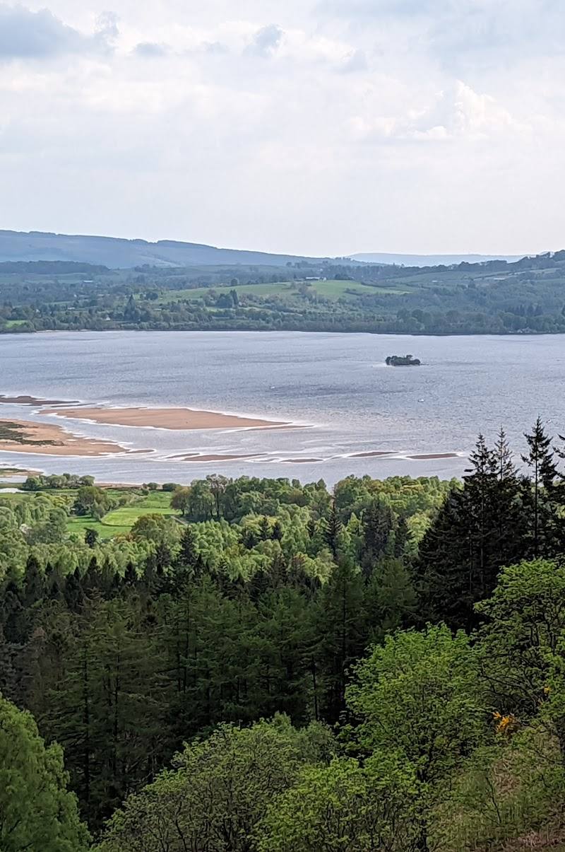
Walk from Balmaha towards the summit, taking the climb at your own pace. The reward is a wide view over Loch Lomond and its islands; the ascent is steep in places, so allow time for breaks and the return.
Things to do
Climb to the summit viewpoint
Take the path from Balmaha uphill to the summit area for views over Loch Lomond, its islands and, on clear days, the surrounding Highlands.
About 1.5–3 hours for the walk, according to a supplied source.
Look out across Loch Lomond’s islands
From the hill, pick out the islands scattered across the loch; the supplied sources name Inchcailloch, Inchcruin, Bucinch and Inchfad.
Join the West Highland Way
Conic Hill forms part of the West Highland Way. The supplied guide also describes the longer Drymen-to-Balmaha section, a 7-mile walk that descends the hill.
The longer Drymen-to-Balmaha walk is described as 7 miles; duration not supplied.
Make a day of it
Quick escape · About 1.5–3 hours, according to a supplied source; allow for conditions and your pace.
Quick Escape: the summit and back
- 01
Start from the Balmaha Visitor Centre car park, after checking current access and parking arrangements.
- 02
Follow the path uphill towards Conic Hill, taking care on the steeper section.
- 03
Pause for views across Loch Lomond and its islands, then return by your outward route.
Half day · Half day
Make a half day of it: Conic Hill and Balmaha
- 01
Walk from Balmaha to the summit and back, allowing time for the climb and viewpoint.
- 02
Spend time taking in the loch and island views rather than treating the summit as a quick turnaround.
- 03
Finish back in Balmaha; check locally for any food or visitor facilities before relying on them.
Verified history
Conic Hill lies on the Highland Boundary Fault and forms part of the West Highland Way. A supplied local guide reports a major path-repair programme following a 2020 path survey, with more than £900,000 invested by Loch Lomond & The Trossachs National Park Authority in a three-year project. The source says the guide was updated in November 2024 as the works neared completion; check current path conditions before visiting.
Hidden details
A hill on a geological boundary — Conic Hill sits on the Highland Boundary Fault, a geological line identified in the supplied sources. The hill’s position helps frame the transition between Loch Lomond and the Highlands beyond.
A repaired path under pressure — The supplied local guide describes significant pressure on the path from rising visitor numbers and a major stone-pitching repair project. It reports an estimate of around 250,000 hill climbs a year; treat this as the guide’s estimate, not a current count.
When to go
· Choose a clear-weather window for the views. Check the forecast and plan to complete the return in daylight.
Supplied sources describe spring flowers and autumn colours, but do not establish specific peak dates. Visibility matters for the loch and mountain views.
Hill conditions and visibility affect both the experience and the walk. A supplied source warns of steep sections and occasional muddy or rocky patches; check the forecast and current path conditions.
The route
- surface
- A supplied source notes occasional muddy and rocky patches; another describes path repairs. Current surface conditions need checking.
- duration
- About 1.5–3 hours for the summit walk, according to one supplied source; confirm locally and allow for conditions.
- difficulty
- Steep in places; a supplied source describes a steeper incline near the peak and occasional muddy or rocky patches.
- waymarking
- Check before visiting
- route shape
- Out and back from Balmaha to the summit is described as an option; a longer circular option is also mentioned by a supplied source.
- start point
- Balmaha Visitor Centre car park is identified as a starting point in a supplied source.
- parking start
- The supplied source identifies the Balmaha Visitor Centre car park. Check current availability and arrangements.
- Summit views over Loch Lomond and its islands
- Views towards the Highlands, including Ben Lomond and the Arrochar Alps when visibility allows
- A section of the West Highland Way
Worth pairing with
Balmaha
Use the village as the walk’s starting area; the supplied sources identify a Balmaha Visitor Centre car park and describe the hill as rising above the village. Check facilities and parking before travelling.
Drymen to Balmaha on the West Highland Way
For a longer walking day, the supplied guide describes a 7-mile West Highland Way section from Drymen to Balmaha, finishing with a descent of Conic Hill.
What to look for
From the upper path and summit, look across Loch Lomond to its scattered islands, then towards Ben Lomond and the Arrochar Alps when visibility allows. Notice the change in gradient as the path steepens near the top.
The story
The Highland Boundary Fault; the hill also lies on the West Highland Way.
Best time to go
Clear days in any season; spring and autumn are noted by the supplied sources as especially scenic.
Choose a clear day for the broadest views over the loch and towards the Highlands. Early or late light may suit photography, but check conditions and plan your return in daylight.
How long to spend
Half day
Perfect for
Walkers · Photographers · Families
Route at a glance
Duration
Half day
Terrain
Hills, Lakeside
Parking / start
The supplied sources identify the Balmaha Visitor Centre car park as a starting point. Check availability and current arrangements before travelling.
Before you go
Address
Google rating
Practical information
Opening & access
A popular hill walk from Balmaha, with a path to the summit. Check current access and path conditions before setting out.
Check before visiting
Parking
The supplied sources identify the Balmaha Visitor Centre car park as a starting point. Check availability and current arrangements before travelling.
Check before visiting
Toilets
Check before visiting
Check before visiting
Food & drink
Check before visiting
Check before visiting
Dogs
A supplied source describes the walk as dog-friendly with close observation; check current guidance and signage before visiting.
Check before visiting
Accessibility
The route includes a steep climb and can have muddy or rocky sections; it is not described as step-free. Check current path conditions before visiting.
Check before visiting
Cost
Check before visiting
Check before visiting
Water
Loch
Gallery
Place photographs
Keep exploring
Around Conic Hill
Within 50 km · approximate straight-line distances