5.8
Wildland
1–2 hours
Time
Check
Cost
Wild
Feel
Why it's Wildland
5.8A steep chalk hill above the fields near Warminster, ringed by Iron Age earthworks and holding Bronze Age burial mounds within its summit defences.
Cley Hill brings together a commanding open-hilltop view, chalk grassland, flowering orchids and visible layers of prehistoric and medieval landscape. Its short summit climb offers more to notice than the view alone.
Wild · Atmospheric
Find your way
Open mapNear Warminster, Wiltshire, England
Opening map…
Know this place a little better?
The experience
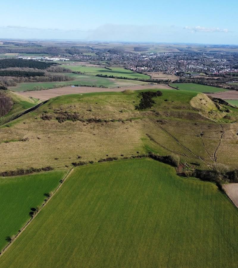
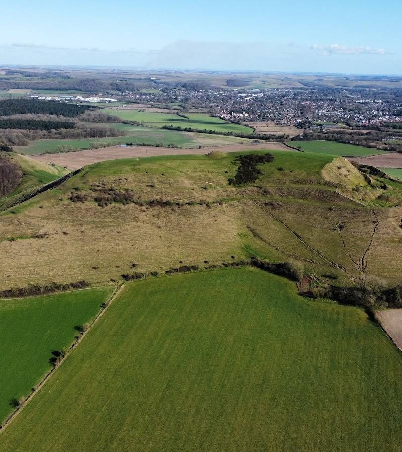
Climb from the small car park to the hilltop earthworks, look for the bowl barrows within the ramparts, then take in the view towards Little Cley Hill and Warminster.
Things to do
Climb through the earthworks
Follow the path up the hill through the strip lynchets and summit ramparts. The climb is short but steep.
About 10 minutes uphill, according to the source
Find the Bronze Age bowl barrows
Look inside the summit’s Iron Age defences for the prominent bowl barrow and a less obvious second mound.
Trace the medieval strip lynchets
Notice the terraced farming lines on the south-west slopes, where sections of the ramparts were levelled.
Take in the summit view
From the summit, look towards the distinctive outline of Little Cley Hill and the town of Warminster.
Make a day of it
Quick escape · About 20–30 minutes, plus time at the summit
Quick summit climb
- 01
Start from the small car park off the A362.
- 02
Follow the farm lane to the base of the hill and pass through the gate.
- 03
Climb the path through the slope earthworks to the summit.
- 04
Look for the bowl barrows and ramparts, then enjoy the view before returning the same way.
Half day · Around 1–2 hours
Hilltop history and the wider view
- 01
Walk from the A362 car park to the summit using the described hill path.
- 02
Explore the Iron Age ramparts and identify the bowl barrows within them.
- 03
Look for the medieval strip lynchets on the south-west slopes.
- 04
Spend time at the northern summit end for views towards Little Cley Hill and Warminster.
Verified history
Cley Hill’s summit is enclosed by Iron Age ramparts, with several Bronze Age bowl barrows inside the defences. Medieval strip lynchets cut across parts of the south-west slope. The supplied history source says antiquarians William Cunningham and Richard Colt Hoare explored a bowl barrow in the nineteenth century; a depression remains on its top. The hill was formerly part of the Longleat estate and was given to the National Trust by the 6th Marquis of Bath.
Folklore & legend
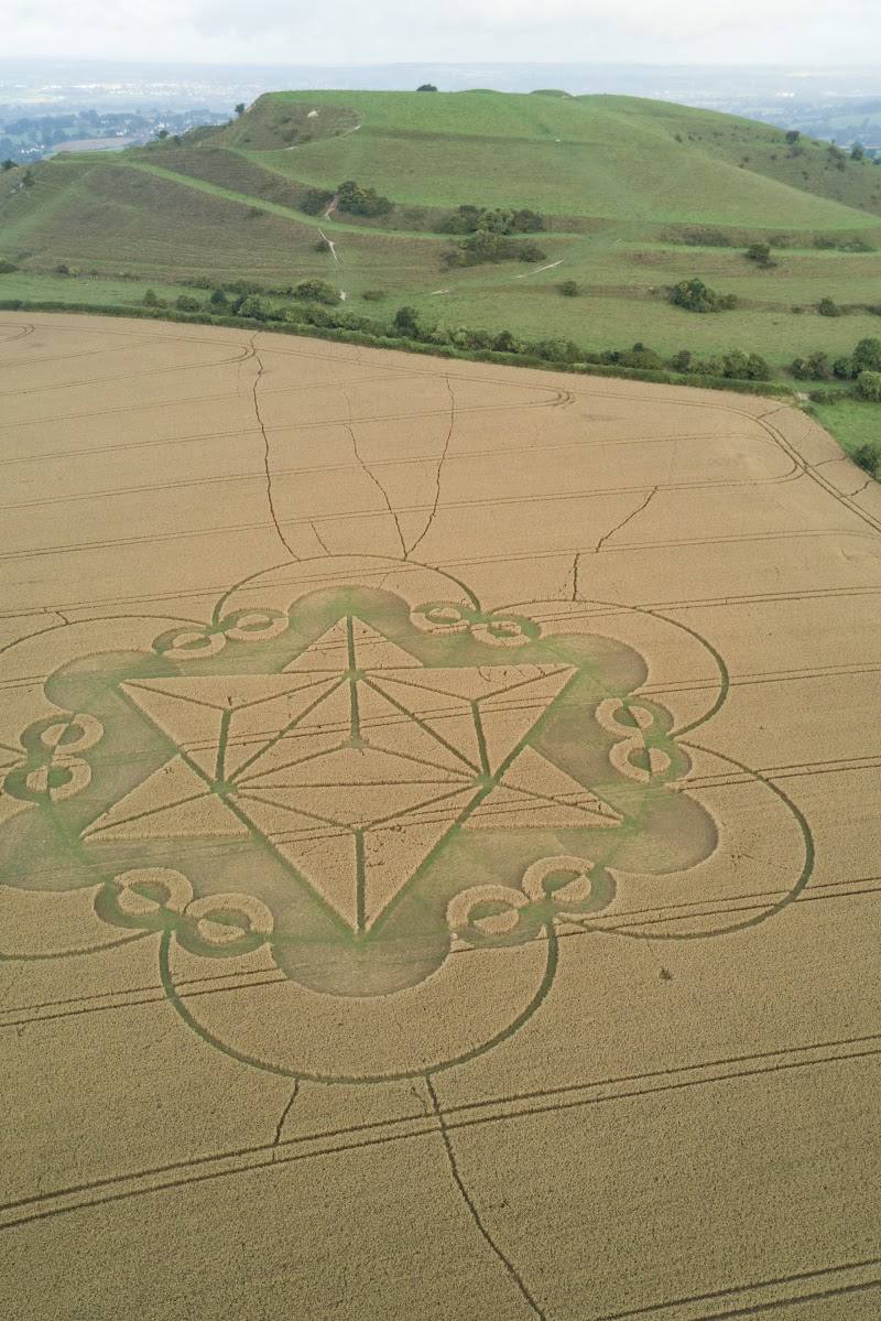
Warminster Town Council describes Cley Hill as a famous UFO hotspot. Treat this as local UFO lore, not verified history.
Hidden details
The second, less obvious barrow — Alongside the large bowl barrow inside the summit defences, the history source notes a smaller, less obvious mound.
A depression left by antiquarians — The top of the prominent bowl barrow bears a depression associated by the source with nineteenth-century antiquarians William Cunningham and Richard Colt Hoare, who found nothing inside.
When to go
April · May · June · Choose a clear, calm day for the summit views. Check conditions after rain, as the approach lane can be muddy.
The chalk slopes support flowering orchids and a wide variety of plants; the supplied sources do not specify exact flowering dates.
The approach lane may be muddy, particularly after rain. The exposed summit may be breezy; dress for changing hilltop conditions.
What to look for
Look for the Iron Age ramparts around the summit, the bowl barrows inside them, medieval strip lynchets on the south-west slope and the triangulation point at the northern end. The chalk slopes support more than 100 plant species, including orchids.
The story
Archaeology
Best time to go
Spring to early summer for flowering plants; choose a clear day for the broad summit views.
A clear, calm day gives the best chance of enjoying the summit views. In wet weather, expect the approach lane to be muddy.
How long to spend
1–2 hours
Perfect for
Walkers · Photographers · History lovers · Wildlife lovers
Before you go
Address
Google rating
Practical information
Opening & access
The National Trust owns the land. A small car park off the A362 and a path to the summit are described by the supplied source. The route climbs steeply and the lane can be muddy; check current access and conditions before visiting.
Check before visiting
Parking
A small car park off the A362 is described by a supplied source. Check current availability before travelling.
Check before visiting
Toilets
Check before visiting
Check before visiting
Food & drink
Check before visiting
Check before visiting
Dogs
Check current rules before visiting.
Check before visiting
Accessibility
The summit path climbs steeply over a short distance; the approach lane may be muddy. No step-free route information is available in the supplied sources.
Cost
Check before visiting
Check before visiting
Gallery
Place photographs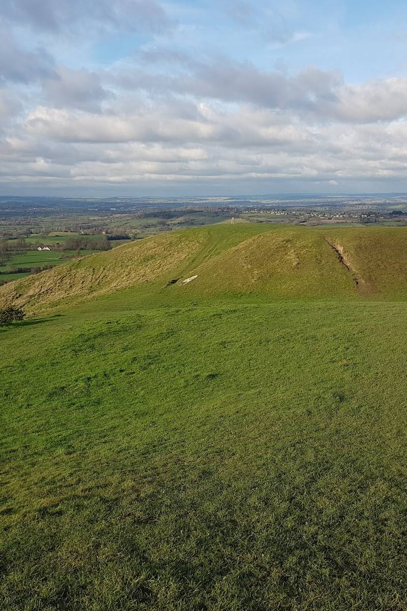
Keep exploring
Around Cley Hill
Within 50 km · approximate straight-line distances