5.2
Wildland
Under 1 hour
Time
Check
Cost
Check before visiting
Feel
Why it's Wildland
5.2Created as part of a flood-mitigation project, the wetlands are designed to collect and treat surface-water runoff while adding habitat and public amenity space to Chestnuts Field.
A local, practical example of wetlands designed to do two jobs: help manage flood risk and create habitat. The council describes plans for viewing platforms and seating, but current visitor facilities and access details need checking.
Check before visiting
Find your way
Open map588 Forest Road, London E17 3ED
Opening map…
Know this place a little better?
The experience
A short look at a newly created urban wetland project. The council describes three connected basins intended to manage runoff and improve water quality. Current access, the completion of planned viewing platforms and suitable walking routes should be checked before setting out.
Things to do
See the flood-management wetlands
The council describes three connected basins designed to direct surface-water runoff into the wetlands and help reduce flood risk.
Look for the water-treatment planting
The council says the first basin is intended to act as a sediment trap and first treatment stage, with plantings in the other two basins intended to reduce pollution.
Make a day of it
Quick escape · Under 1 hour
A brief look at the wetlands
- 01
Check current access arrangements before travelling.
- 02
If access is available, view the wetland basins from permitted public areas.
- 03
Check whether the council’s planned viewing platforms and seating are now in place.
Verified history
Waltham Forest Council describes the Chestnuts Field Flood Mitigation Project as a scheme to help protect properties on Sturge Avenue and Spruce Hills Road from surface-water flooding and reduce downstream flood risk. Its design includes three interconnected basins, water-treatment measures and wetland habitat. The council’s account also describes two viewing platforms and seating as planned additions; it does not establish whether these have since been completed.
Hidden details
The wetlands have a flood-management role — The basins were designed to receive runoff and help mitigate surface-water flooding, as well as provide community amenity space and habitat.
The basins have different treatment functions — The council describes the first basin as a sediment trap and initial treatment stage, with pollution-reducing plantings in the other two.
When to go
· No evidence-based recommendation available.
The supplied source gives no seasonal wildlife or visitor information.
Check local conditions and current access before visiting; no site-specific weather guidance is available in the supplied evidence.
What to look for
- 01
The three interconnected basins described in the council’s project account, and the planted areas intended to help reduce pollution. The council also describes two viewing platforms and seating as planned features
- 02
confirm whether they are in place.
Best time to go
Check before visiting; the supplied evidence does not identify seasonal highlights.
No specific best time is established by the supplied evidence. Check current access and conditions before visiting.
How long to spend
Under 1 hour
Perfect for
Walkers · Wildlife lovers
Before you go
Address
Website
Google rating
Practical information
Opening & access
Waltham Forest Council describes the wetlands as community amenity space for public use. Check current access arrangements before visiting.
Check before visiting
Parking
Check before visiting
Check before visiting
Toilets
Check before visiting
Check before visiting
Food & drink
Check before visiting
Check before visiting
Dogs
Check before visiting
Check before visiting
Accessibility
The source record reports a wheelchair-accessible entrance; path and viewing-area accessibility are not confirmed. Check before visiting.
Check before visiting
Cost
Check before visiting
Check before visiting
Water
Marsh
Gallery
Place photographs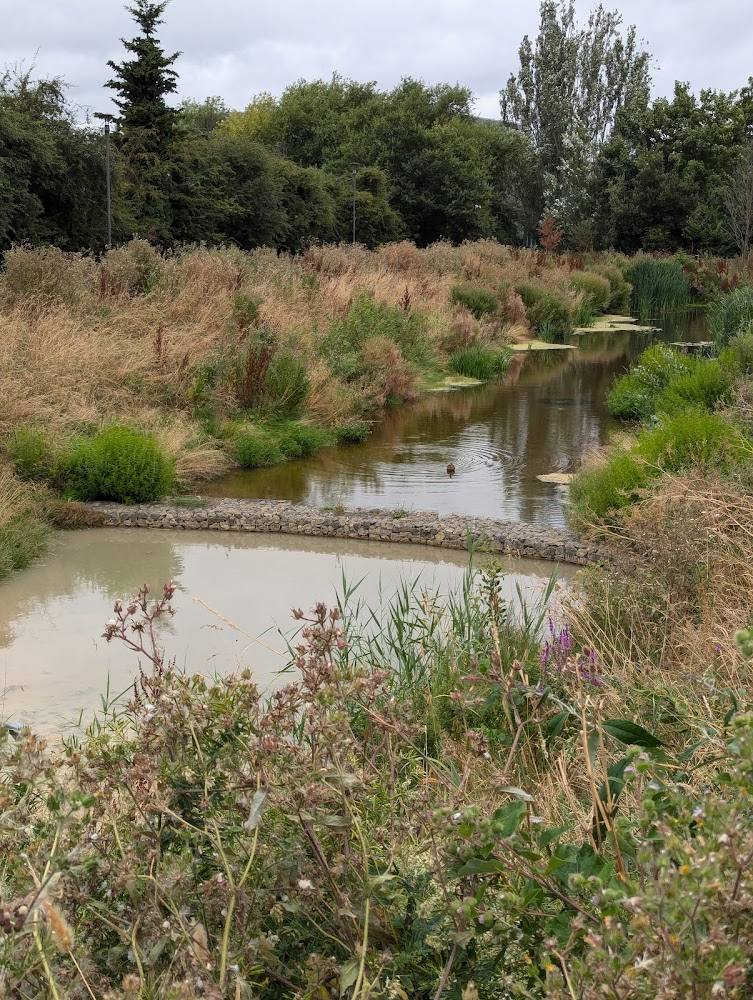
Keep exploring
Around Chestnuts Field Wetlands
Within 50 km · approximate straight-line distances