Muir of Dinnet National Nature Reserve, near Aboyne, Aberdeenshire
Burn O’Vat
Unusual place
Place photograph
8.5
Wildland
1–2 hours
Time
Check
Cost
Dramatic
Feel
Why it's Wildland
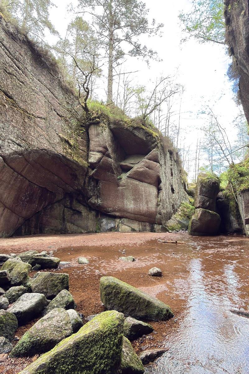
8.5A stream-carved rock cauldron in the Cairngorms: the Vat is a glacial pothole about 18 metres across and 13 metres high, with a narrow entrance that leads into its bowl-shaped interior.
This is an unusually dramatic piece of ice-age geology you can enter on foot. The Vat’s enclosed rock walls and the stream that carved them make a short visit feel like a genuine discovery; nearby Loch Kinord offers a worthwhile longer walk through the reserve.
Dramatic · Atmospheric · Wild
Find your way
Open mapMuir of Dinnet National Nature Reserve, near Aboyne, Aberdeenshire
Opening map…
Know this place a little better?
The experience
Make the Vat itself the focus of a short visit, then extend the day with the waymarked circuit around Loch Kinord. The longer loop adds woodland, lochside scenery and traces of past settlement; check route conditions and access details before you go.
Things to do
Enter the glacial pothole
Follow the short approach to the Vat and pass through its narrow rock entrance to see the bowl-shaped pothole from inside, if conditions and access allow.
Short visit; exact duration not provided
Walk the Loch Kinord circuit
Take the longer loop through pine and birch woodland around Loch Kinord, with a diversion to Burn O’Vat. The supplied route listing gives a distance of 6.2 miles and an estimated duration of 2–2.5 hours.
2–2.5 hours
Look for traces of settlement around Loch Kinord
The supplied walk and video sources identify Crannog Island, Castle Island and the Kinord Pictish stone as points of interest on the loch circuit.
Look for summer water lilies at Clarack Loch
A supplied account of the Loch Kinord walk describes a viewing platform at Clarack Loch and water lilies there in summer. This is a feature of the longer reserve walk, not the Vat itself.
Make a day of it
Quick escape · Allow 1–2 hours; exact visit duration is not specified in the sources.
Quick escape: step inside the Vat
- 01
Start from the reported site car park and follow the short approach to Burn O’Vat.
- 02
Pass through the narrow rock crack into the bowl-shaped pothole, if conditions and access allow.
- 03
Pause to take in the scale of the rock walls and the stream-carved setting, then return by the approach.
Half day · The full Loch Kinord and Burn O’Vat loop is listed as 6.2 miles and 2–2.5 hours; allow extra time for stops.
Make a half day of it: Vat and Loch Kinord
- 01
Visit the Vat and take time to look at the pothole’s shape and narrow entrance.
- 02
Continue on the longer circuit around Loch Kinord, following the route information and signage available on site.
- 03
Pause at the loch and look for the Crannog and Castle islands and the Kinord Pictish stone, identified in the supplied route and video sources.
- 04
Check current route conditions and access arrangements before setting out.
Verified history
Burn O’Vat is a glacial pothole formed by swirling meltwater carrying rocks and boulders. The supplied source estimates that the surrounding area was under an ice sheet around 16,000 years ago; as the ice melted, a rock lodged in a hollow in the stream bed and the circulating water eroded the bed beneath it. The pothole is reported to measure about 18 metres across and 13 metres high from present ground level. The source says a waterfall later undercut the rock in front of the pothole, exposing its entrance around 12,000 years ago. The longer Loch Kinord walk also passes sites associated with past settlement, including Crannog Island, Castle Island and the Kinord Pictish stone.
Hidden details
The Vat is much taller than its entrance suggests — The source gives the pothole’s dimensions as about 18 metres across and 13 metres high from present ground level. The narrow rock crack provides a striking contrast with the space inside.
Look beyond the Vat on the loch circuit — The longer walk includes archaeological and historic points around Loch Kinord, including Crannog Island, Castle Island and the Kinord Pictish stone.
When to go
· No specific time of day is established by the supplied sources; check conditions before setting out.
The supplied sources mention water lilies at Clarack Loch in summer but do not establish a best season for visiting Burn O’Vat itself.
The route enters a rocky feature and includes paths through a reserve. Check current conditions before visiting; the supplied sources do not provide specific weather or path-condition advice.
The route
- ascent
- 269 ft
- distance
- 6.2 miles for the Loch Kinord and Burn O’Vat loop
- duration
- 2–2.5 hours
- difficulty
- Moderate
- waymarking
- The TripAdvisor excerpt describes waymarked trails; confirm current on-site waymarking.
- route shape
- Loop
- start point
- The AllTrails route is for Dinnet, Loch Kinord and Burn O’Vat; a YouTube source says its Loch Kinord walk starts from the public car park in Dinnet. Confirm the correct start for the chosen route.
- parking start
- The source row reports a car park at Burn O’Vat; the supplied video describes a public car park in Dinnet as the start of its Loch Kinord circuit. Confirm current parking and route access.
- shorter alternative
- Visit Burn O’Vat by the short approach from the reported site car park; the supplied sources do not give a measured distance or duration.
- Burn O’Vat glacial pothole
- Woodland around Loch Kinord
- Crannog Island and Castle Island
- Kinord Pictish stone
Worth pairing with
Loch Kinord
Pair the Vat with the longer lochside circuit for woodland scenery and the historic sites noted along the route.
Clarack Loch
A supplied account of the reserve walk describes a viewing platform and summer water lilies at this loch.
What to look for
Notice the sudden change from the narrow rock entrance to the Vat’s broad, bowl-shaped interior. Look for the stream and waterfall that helped expose the pothole, and, on a longer Loch Kinord walk, watch for the Crannog and Castle islands and the Kinord Pictish stone.
The story
Ice-age geology; prehistoric and Iron Age remains are noted around Loch Kinord.
Best time to go
Check local conditions before setting out. The supplied sources describe the surrounding loch and reserve as rewarding for wildlife and seasonal water lilies in summer.
Choose a clear spell when the approach and rock surfaces are safe underfoot. For a longer reserve visit, the supplied sources note summer water lilies at Clarack Loch and wildlife around Loch Kinord.
How long to spend
1–2 hours
Perfect for
Walkers · Photographers · Wildlife lovers · Families
Before you go
Practical information
Opening & access
A short walk from the car park leads to the Vat; reaching its interior involves passing through a narrow crack in the rock. Check current access and path conditions before visiting.
Check before visiting
Parking
A car park is reported at the site. The source row reports wheelchair-accessible parking; check current details before visiting.
Check before visiting
Toilets
Check before visiting
Check before visiting
Food & drink
Check before visiting
Check before visiting
Dogs
Check before visiting
Check before visiting
Accessibility
The source row reports a wheelchair-accessible car park. It does not establish that the trail or Vat entrance is wheelchair accessible; the route into the Vat passes through a narrow crack.
Cost
Check before visiting
Check before visiting
Water
Stream
Gallery
Place photographs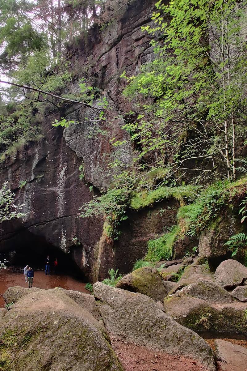
Keep exploring
Around Burn O’Vat
Within 50 km · approximate straight-line distances
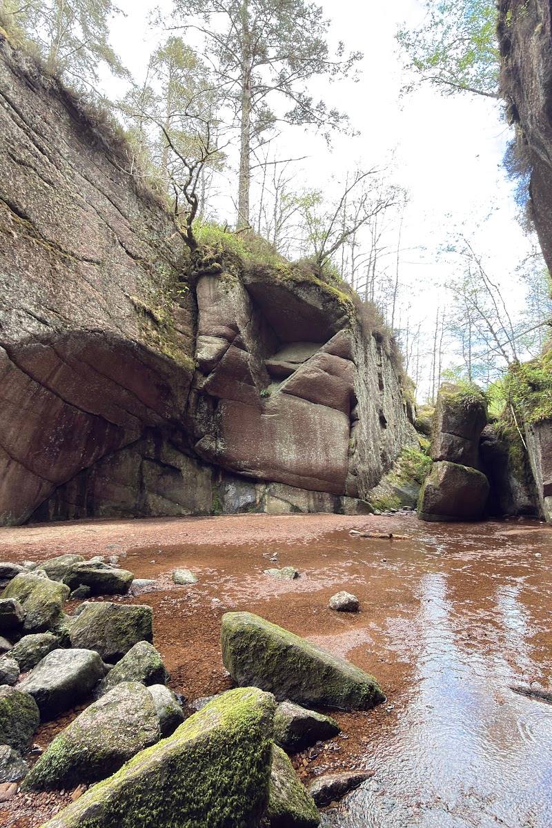
 Place photograph8.6
Glen Tanar National Nature Reserve
Near Aboyne, Royal Deeside, Aberdeenshire
6.3 km away
 Place photograph5.3
Aboyne Loch Caravan Park
Aboyne, Royal Deeside, Aberdeenshire, Scotland
11.2 km away
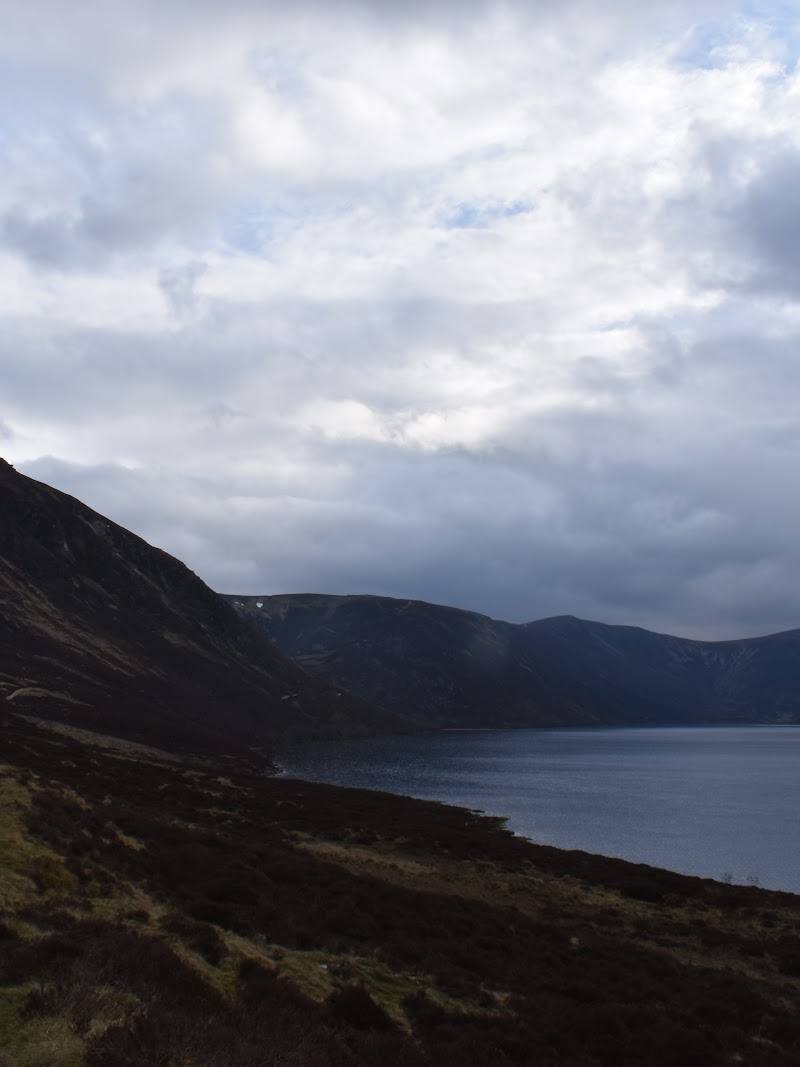
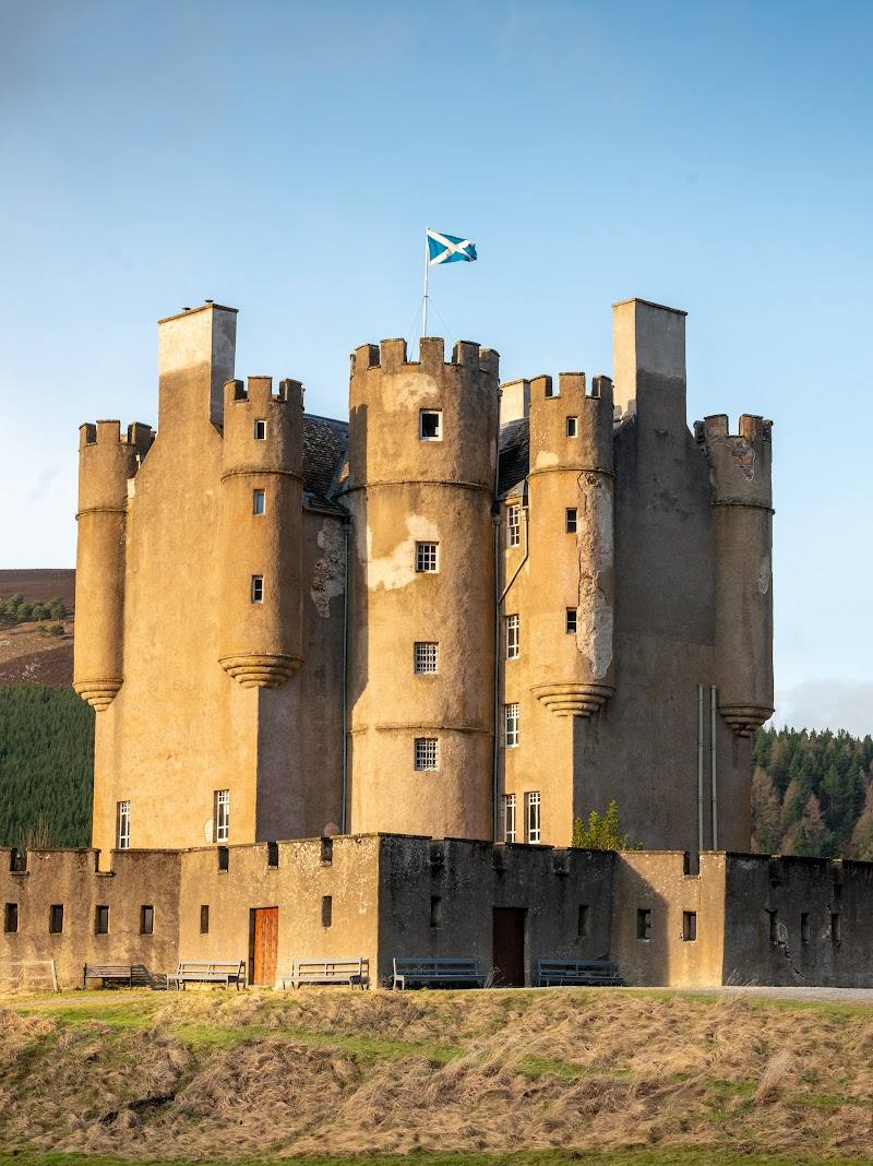
 Place photograph8.3
Loch Callater
Glen Callater, near Braemar, Cairngorms National Park, Scotland
28.6 km away