7.0
Wildland
Half day
Time
Check
Cost
Dramatic
Feel
Why it's Wildland
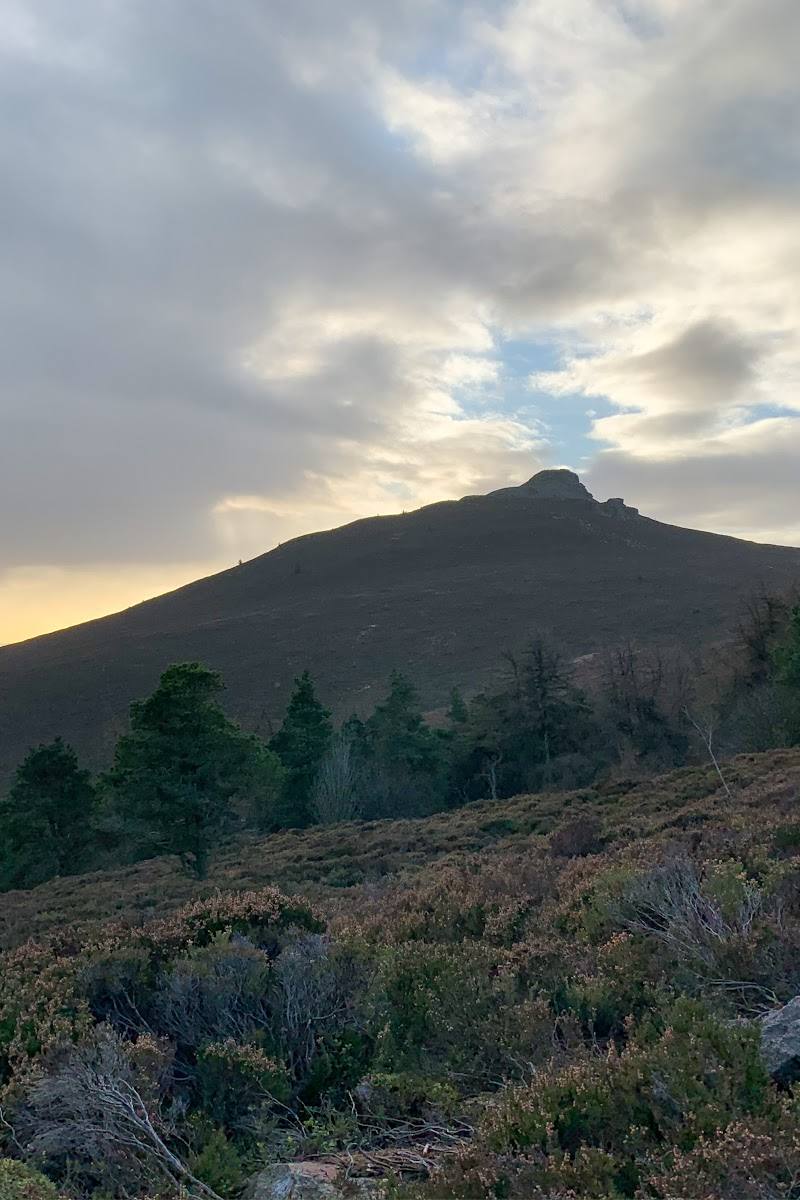
7.0A distinctive, conical wooded hill above Aberdeenshire, with routes towards Mither Tap and wide views across the surrounding countryside.
Bennachie offers more than a summit tick: wooded approaches, moorland views and several ways to shape a walk make it a rewarding hill day. The supplied information does not establish route distances or current conditions, so plan from an up-to-date map rather than relying on a fixed itinerary.
Dramatic · Wild · Big-sky
Find your way
Open mapNear Inverurie, Aberdeenshire
Opening map…
Know this place a little better?
The experience
Choose a route towards Mither Tap or another hill destination using current trail information. The supplied sources confirm multiple trails and woodland and moorland scenery, but do not provide enough detail to prescribe a safe, measured circuit.
Things to do
Walk a Bennachie trail
Choose from the hill range’s walking routes using current trail information. The visitor-centre source identifies it as a starting point for exploring Bennachie.
Head towards Mither Tap
Mither Tap is named in a visitor account describing a walk among Bennachie’s peaks. Confirm the route, conditions and time needed before attempting it.
Look out across the hill country
Visitors mention views from the hill and from routes in the area. Visibility depends on conditions, so check the forecast before setting out.
Make a day of it
Quick escape · Duration not established; check route information before setting out.
Quick hill escape
- 01
Start from a confirmed Bennachie access point.
- 02
Choose a short route from current local trail information rather than assuming a route length.
- 03
Take in the wooded slopes and moorland views, then return by the route you came.
Half day · Not established by the supplied sources.
Walk towards Mither Tap
- 01
Check current route details and the weather before choosing a hill walk.
- 02
Follow a confirmed trail towards Mither Tap.
- 03
Allow time for the woodland approach and views; return using the route guidance for your chosen trail.
When to go
· A clear day is preferable for views; the sources do not establish a best time of day.
The supplied sources do not support a particular seasonal recommendation.
Check the forecast and route conditions before a hill walk. The supplied sources do not provide specific weather or safety guidance.
What to look for
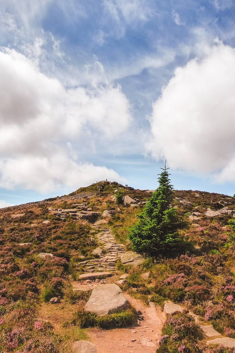
Notice the change from wooded slopes to more open moorland, and look for the conical profile of Mither Tap as you approach the hill.
Best time to go
Not established by the supplied sources; check forecast and ground conditions before visiting.
Choose a clear, settled day for the best chance of far-reaching views. Check the forecast and conditions before leaving.
How long to spend
Half day
Perfect for
Walkers · Photographers
Before you go
Address
Google rating
Practical information
Opening & access
A hillwalking destination with multiple trails; the Bennachie Visitor Centre is described as a starting point for exploring the hill range. Check current access, route conditions and visitor-centre details before setting out.
Check before visiting
Parking
The visitor-centre source mentions a large car park, but does not establish its current availability or whether it serves every route. Check before travelling.
Check before visiting
Toilets
The visitor-centre source lists toilets; check current availability before visiting.
Check before visiting
Food & drink
The visitor-centre source mentions hot and cold drinks, ice cream and snacks from its gift shop. Check current opening and availability.
Check before visiting
Dogs
Check current access guidance and on-site signs before visiting.
Check before visiting
Accessibility
Hill routes are described, but trail surfaces, gradients and step-free access are not established. Check route suitability before setting out.
Check before visiting
Cost
Check before visiting
Check before visiting
Gallery
Place photographs
Keep exploring
Around Bennachie
Within 50 km · approximate straight-line distances

 Place photograph8.2
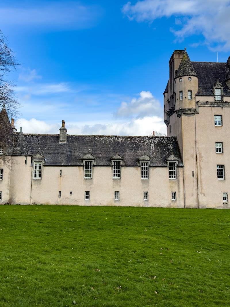
Castle Fraser, Garden & Estate
Sauchen, near Inverurie, Aberdeenshire AB51 7LD
11.0 km away

 Place photograph5.3
Aboyne Loch Caravan Park
Aboyne, Royal Deeside, Aberdeenshire, Scotland
25.0 km away
 Place photograph7.7
Drum Castle, Garden & Estate
Drumoak, near Banchory, Aberdeenshire AB31 5EY
25.1 km away