Holyrood Park, Edinburgh, Scotland EH15 3PY
Arthur’s Seat
Viewpoint
Place photograph
6.8
Wildland
1–2 hours
Time
Free
Cost
Dramatic
Feel
Why it's Wildland
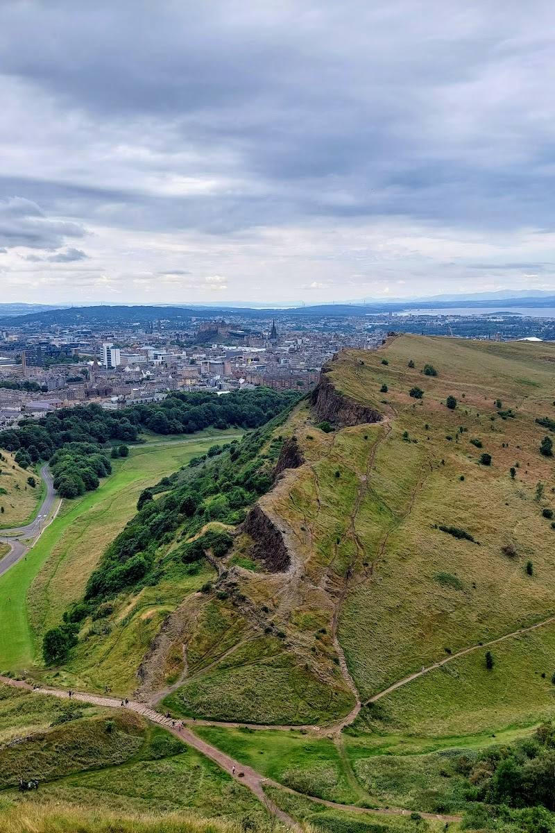
6.8From the summit of an extinct volcano, Edinburgh’s rooftops give way to views across the Firth of Forth and towards Fife. The climb is short enough to fit into a city visit, but rocky ground and an exposed summit make it feel like a proper hill walk.
Arthur’s Seat earns its place through an unusually strong meeting of city and wild landscape: volcanic rock, open hillside and panoramic views sit within walking distance of central Edinburgh. The summit is a memorable goal, but the park’s other paths and the quieter Nether Hill offer reasons to explore beyond the busiest ascent.
Dramatic · Big-sky
Find your way
Open mapHolyrood Park, Edinburgh, Scotland EH15 3PY
Opening map…
Know this place a little better?
The experience
Climb to the rocky summit for sweeping views, or take a gentler walk through Holyrood Park and explore its other paths. Route choice matters: the ascent can be steep, and exposed rock may become slippery in wet weather.
Things to do
Climb to the summit
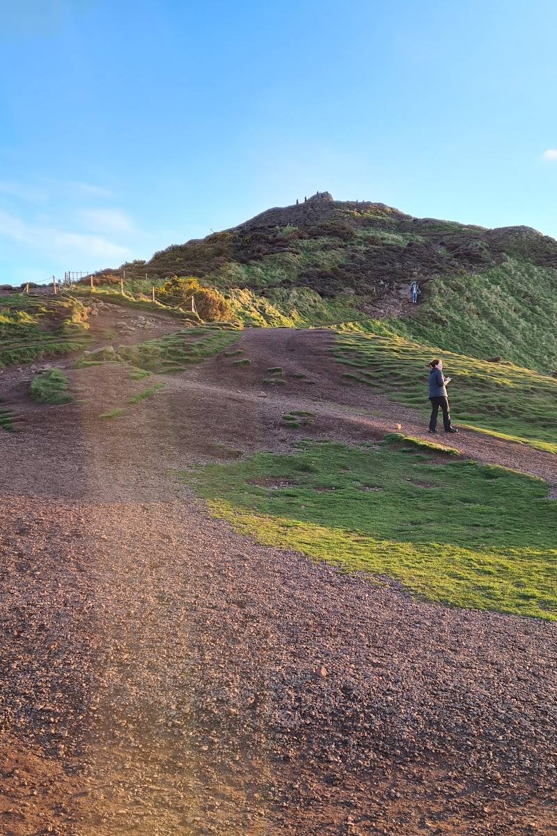
Follow a Holyrood Park path uphill to the rocky top. Routes vary, and the final section is exposed; choose your approach to suit your ability and the weather.
30 minutes to a couple of hours for the ascent, depending on route and pace
Look across the city and the Firth of Forth
From the top, take in Edinburgh and, on a clear day, the views towards the Firth of Forth and Fife.
Explore beyond the summit
Holyrood Park has multiple paths and flatter areas for a less summit-focused walk. The Nether Hill is described as a nearby promontory with a similar panorama that may feel quieter.
Make a day of it
Quick escape · 1–2 hours
Quick Escape: the summit climb
- 01
Start from a suitable Holyrood Park path and choose an ascent that matches your fitness and conditions.
- 02
Climb to the rocky summit, allowing time for the steeper sections.
- 03
Pause for views over Edinburgh and the Firth of Forth, then return by a suitable path.
Half day · Half day
Make a Half Day of It: explore the hill and park
- 01
Walk up to Arthur’s Seat, taking care on the rocky, exposed summit.
- 02
Explore another path through Holyrood Park rather than treating the summit as the only destination.
- 03
If conditions or energy make the summit unsuitable, choose a gentler walk on the park’s flatter ground.
Verified history
Arthur’s Seat is the highest point of a long-extinct volcanic landscape. The supplied sources describe Holyrood Park as having volcanic geology and archaeological remains, including hill forts dated to around 2,000 years ago. The name’s origin is uncertain: proposed explanations include a connection to King Arthur and a Gaelic-derived interpretation.
Folklore & legend
Stories link the hill’s name with King Arthur, but the name’s origin is uncertain and the supplied sources present this as a theory, not established history.
Hidden details
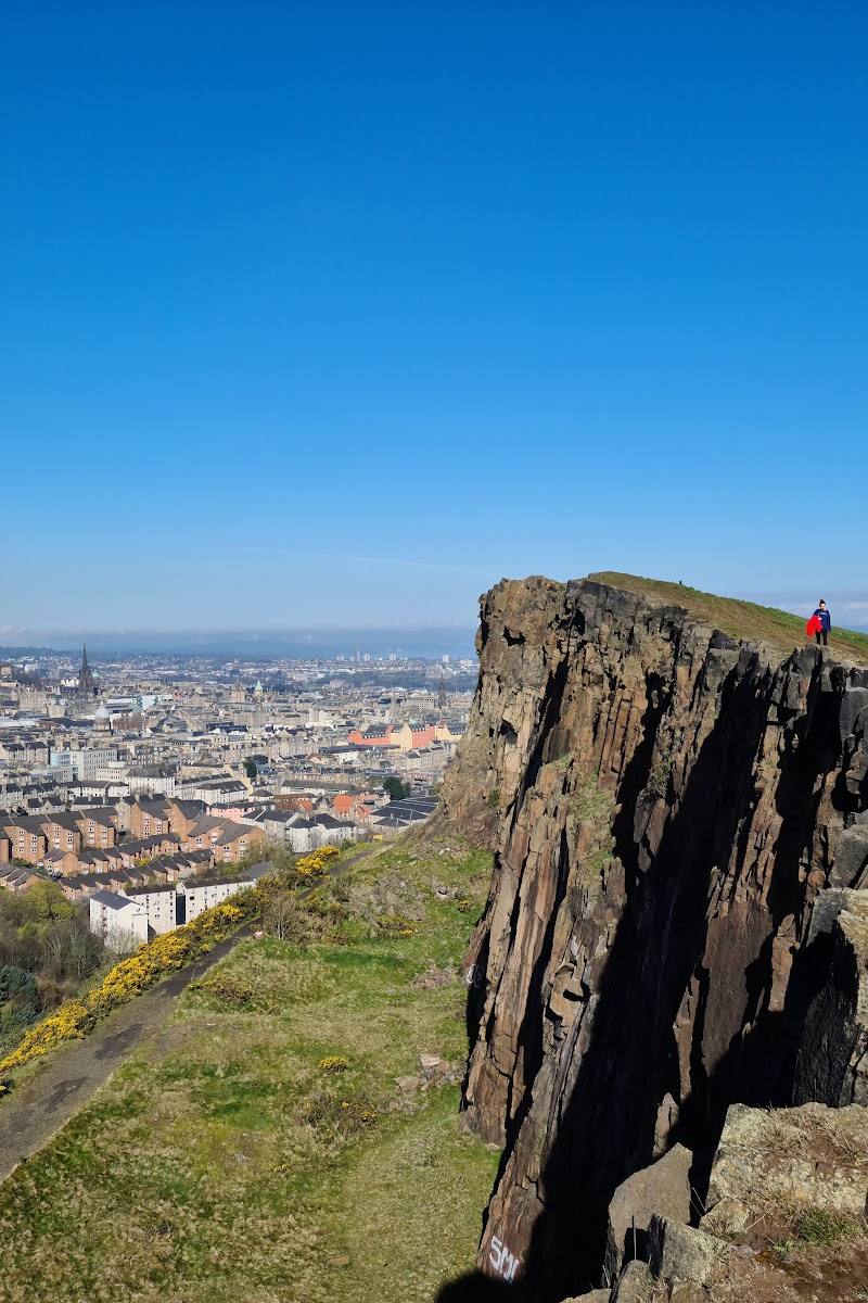
Read the volcanic rock — Look for dark basalt rocks described in the supplied source as evidence of lava flows from the area’s volcanic past.
Try the Nether Hill panorama — A nearby promontory is reported to offer a similar panorama to the main summit and may feel quieter than the most-used route.
When to go
· Choose a clear, settled period for visibility; the supplied sources do not identify a reliably best time of day.
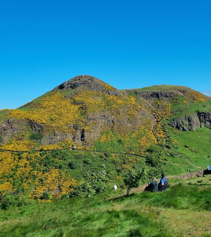
The sources emphasise clear views and warn that wind and wet conditions can make the exposed, rocky summit uncomfortable or slippery. One visitor account notes gorse flowering in spring.
The summit is exposed and can be windy. Rocky paths may be slippery when wet; use footwear with good grip and take care on the final rocky section. Check conditions before setting out.
The route
- surface
- Rocky and uneven in places; loose gravel and slippery rock are reported.
- distance
- Just under 3 miles (4.8 km) for a summit walk, as reported by the supplied source; route choice varies.
- duration
- 30 minutes to a couple of hours for the ascent, depending on route and pace; allow additional time for the return and stops.
- difficulty
- Moderate to strenuous; steep, rocky and exposed in places, with a possible scramble at the summit.
- waymarking
- Check before visiting.
- route shape
- Route-dependent; several paths lead towards the summit.
- start point
- Holyrood Park; the supplied sources mention routes from near Holyroodhouse and Queen’s Drive but do not establish a single required start.
- parking start
- Check before visiting.
- shorter alternative
- Choose a shorter walk on one of Holyrood Park’s flatter paths instead of attempting the summit; confirm route conditions and access before setting out.
- Rocky summit of an extinct volcano
- Panoramic views over Edinburgh
- Views towards the Firth of Forth and Fife
- Dark basalt rock associated with the area’s volcanic past
Worth pairing with
St Anthony’s Chapel ruins
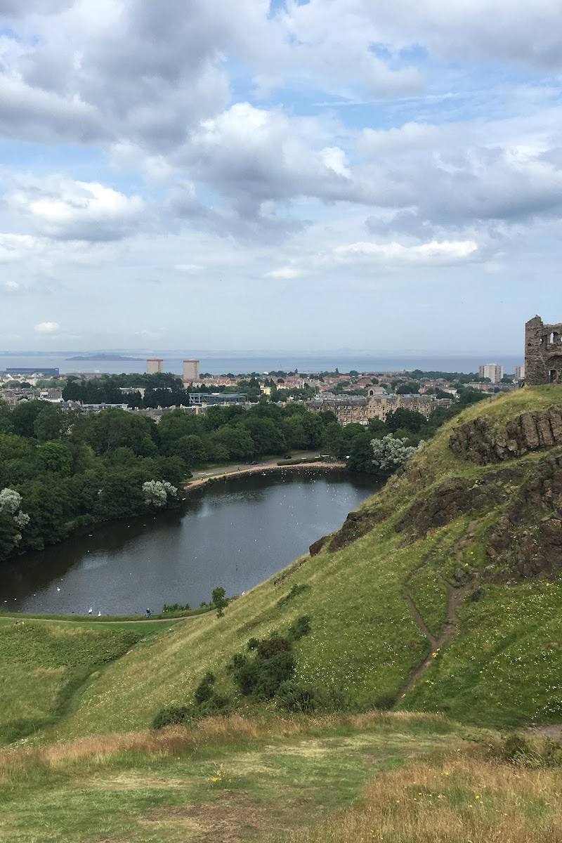
A supplied visitor guide identifies the ruins of St Anthony’s Chapel as another Holyrood Park path destination. Check current access before approaching ruins.
Holyrood Park
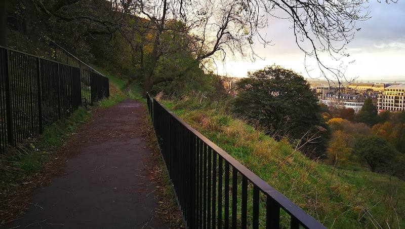
Extend the visit beyond the summit with the park’s other paths and flatter areas.
What to look for
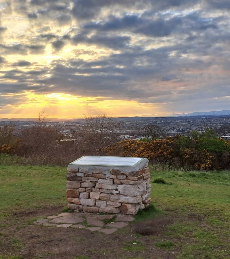
Look for dark basalt rock and other visible traces of the hill’s volcanic origins. From the summit, pick out Edinburgh Castle and the Old and New Town to the west, then look across the Firth of Forth towards Fife. For a quieter panorama, the supplied source recommends the nearby Nether Hill.
The story
Archaeology
Best time to go
Clear, settled weather in any season; spring for the gorse colour noted by visitors.
Choose a clear, settled day for the views. The summit is exposed and can be windy; avoid slippery conditions if you are not confident on steep, rocky ground.
How long to spend
1–2 hours
Perfect for
Walkers · Photographers · History lovers
Before you go
Address
Google rating
Practical information
Opening & access
A hill walk with several possible paths; the summit is rocky, exposed and steep in places. The supplied source describes Holyrood Park and Arthur’s Seat as free to access. Check current access information before visiting, and take particular care on wet or windy days.
Check before visiting
Parking
Check before visiting.
Check before visiting
Toilets
Check before visiting.
Check before visiting
Food & drink
Check before visiting.
Check before visiting
Dogs
Check before visiting.
Check before visiting
Accessibility
The summit route is uphill, rocky and steep in places, with a final rocky section that may require scrambling. The supplied sources also mention flatter areas and other paths in Holyrood Park, but do not establish a step-free route to the summit. Check conditions and choose a route suited to your ability.
Check before visiting
Cost
Free
Gallery
Place photographsKeep exploring
Around Arthur’s Seat
Within 50 km · approximate straight-line distances
 Place photograph6.0
St Anthony’s Chapel Ruins
Holyrood Park, Queen’s Drive, Edinburgh EH8 8JA
0.8 km away
 Place photograph6.5
Easter Craiglockhart Hill Local Nature Reserve
Craiglockhart, Edinburgh, Scotland
4.9 km away